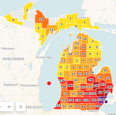
you can see it "spreading" along the freeways here in Michigan -if you look at the county by county map of cases and draw lines connecting the high areas, you've drawn the freeway system. But.... near the freeway system is where most people live..... they all go through Detroit.....
just something I notice when I see this map each day. We're the red 870, right on that freeway linke between Detroit and Chicago

So easy to draw in the main North-South route too.....